
Buying a Home Beside Conservation Land in The Preserve Oakville
November 11, 2026
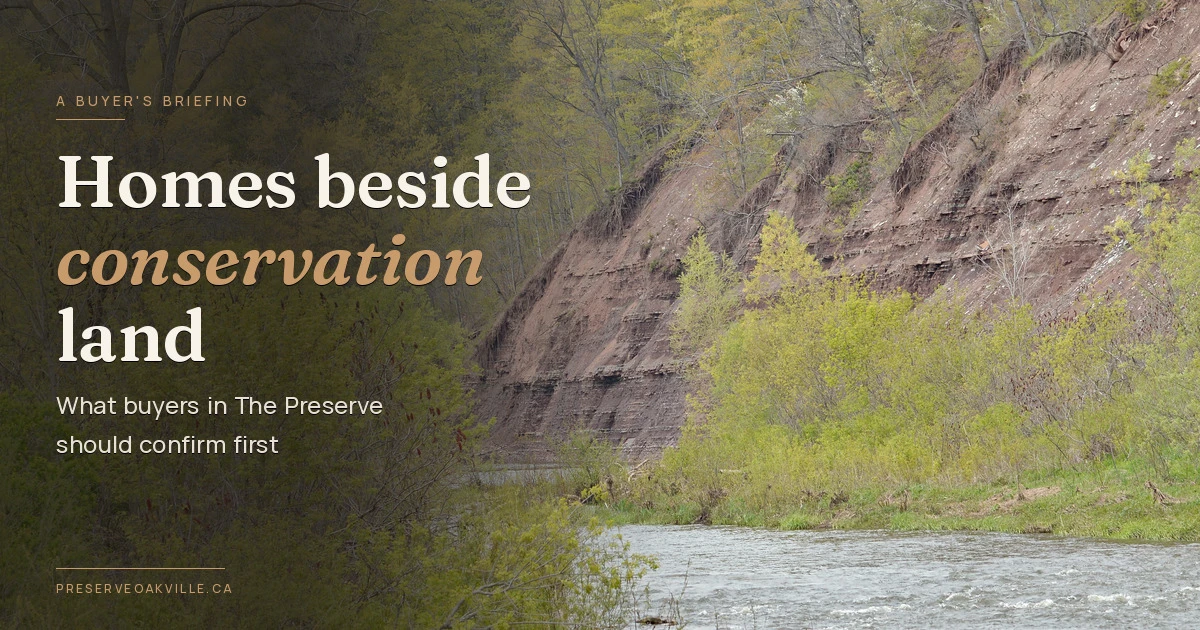
A lot that backs onto a wooded valley, a creek corridor or a protected greenway is often the reason a buyer shortlists a house in The Preserve. The same lot can also come with rules that do not apply on an ordinary interior street: municipal natural-heritage policies, and, on many properties, a Conservation Halton regulated area in which a permit is required before grading, a deck, a pool, a fence or an addition can proceed.
Those two systems are related, but they are not identical. Planning policy decides how land is designated and what a zoning or official-plan amendment can allow. The conservation authority’s regulation decides whether a specific activity on a specific part of a lot may proceed, and on what terms. A listing that says a yard “backs onto greenspace” does not tell you which system applies, or where the line falls.
The outline below is a way to check a particular address against official maps and permit rules. It does not assign any street, lot or builder phase to a regulated area, and it does not replace a property inquiry or a survey.
The short version
The Preserve sits in North Oakville, in the area the Town of Oakville plans through the North Oakville East Secondary Plan: the lands north of Dundas Street and south of Highway 407, between Ninth Line and the centre line of Sixteen Mile Creek.
That plan provides for urban development on the lands outside a defined natural heritage and open space system of protected green spaces and parkland, and it includes an off-road trail system. The Town’s page describes the plan as accommodating about 55,000 people and 35,000 jobs on the lands outside that system.
Conservation Halton administers Ontario Regulation 41/24 under the Conservation Authorities Act. Permission is required for most works in and adjacent to watercourses, flood plains, steep slopes, valley lands, meander belts, wetlands and hazardous land.
Under that regulation, “other areas” in which development activities are prohibited without a permit include lands within 30 metres of a wetland. Apparent river or stream valleys with stable slopes are measured from the stable top of bank plus 15 metres, and further allowances apply where slopes are unstable.
Conservation Halton’s online mapping is a screening tool for the approximate regulation limit. The authority says it will confirm whether a property or a proposal is regulated, and whether a permit is required, if you send a property inquiry.
Do not treat a backyard view, a trail, or marketing language about “backing onto the ravine” as a substitute for that confirmation.
Two official layers: the Town’s plan and the conservation authority
The Town’s North Oakville East Secondary Plan is part of Oakville’s 2006 Official Plan. The official description is geographic rather than neighbourhood-branded: lands north of Dundas Street, south of Highway 407, between Ninth Line and the centre line of Sixteen Mile Creek. Within that area the Town planned a mix of residential, commercial and employment uses, a grid street network, a natural heritage and open space system, an off-road trail system, heritage elements and managed water resources.
The important planning sentence for a buyer is the one the Town puts up front: the plan “allows for higher density urban development — to accommodate about 55,000 people and 35,000 jobs — on the lands outside of the defined natural heritage and open space system.” The homes are meant to sit beside that system, not on top of it. How close a given backyard, side yard or building envelope comes to the protected lands is a lot-level question, answered by the registered plan, any easements or 0.3-metre reserves, the zoning, and, where applicable, Conservation Halton’s regulation limit.
Conservation Halton is a separate body. Since 1972 it has administered a regulation under the Conservation Authorities Act, now Ontario Regulation 41/24, current as of the e-Laws consolidation reviewed for this article (currency date 10 November 2026). The purpose of that regulation, as Conservation Halton describes it, is to prevent loss of life and property damage from natural hazards and to protect and restore the ecosystem in sensitive natural areas. Permission is required to develop in a regulated area, and it may be granted only if the authority is satisfied that the work is not likely to affect the control of flooding, erosion, dynamic beaches, or unstable soil and bedrock, and is not likely to create conditions that, in a natural hazard, might jeopardize health or safety or damage property.
A lot can be outside the natural-heritage designation in the secondary plan and still fall, in whole or in part, inside a conservation-authority regulated area, because the regulation is tied to hazards and to measured distances from wetlands and valley features. The reverse can also occur. The only reliable approach is to check both.
What Ontario Regulation 41/24 actually regulates
The regulation defines a “development activity” broadly. It includes constructing, reconstructing or placing a building or structure; changing a building in a way that alters its use, increases its size or adds a dwelling unit; site grading; and the temporary or permanent placing, dumping or removal of material. A “watercourse” is a defined channel, with a bed and banks or sides, in which water flows regularly or continuously. “Hazardous land” is land that could be unsafe for development because of naturally occurring processes associated with flooding, erosion, dynamic beaches or unstable soil or bedrock.
The measured limits that most often surprise a homeowner are these, taken from the official text of the regulation:
Where a river or stream valley is apparent and has stable slopes, the valley extends from the stable top of the bank, plus 15 metres, to a similar point on the opposite side.
Where the valley is apparent and the slopes are unstable, the 15-metre allowance is measured from the predicted long-term stable slope, including, if the toe is unstable, the predicted location of the toe after stream erosion over a projected 100-year period.
“Other areas” in which development activities are prohibited, for the purposes of the Act, are the areas within 30 metres of a wetland.
Those distances are legal definitions, not a promise that a particular fence line in The Preserve sits 15 or 30 metres from a feature. Only a site-specific review can place the line on a lot. Some small works are excepted from the permit requirement, including, for example, certain unenclosed detached decks or patios of 15 square metres or less that are not in a watercourse or wetland and are not cantilevered. Exceptions are narrow and technical. Relying on an exception without reading the regulation, or without asking Conservation Halton, is a poor way to start a construction project.
Conservation Halton’s permit application materials, updated in a February 2026 form, also set out process rules that come from the regulation: the authority is to notify an applicant in writing within 21 days whether an application is complete, and an applicant may request a review if that notice does not arrive, if the authority treats the application as incomplete, or if a request for more studies appears unreasonable. A person who is refused permission, or who objects to conditions, may appeal to the Ontario Land Tribunal within 30 days of receiving reasons. Those are procedural rights, not a prediction of how any one application will be decided.
How to check a specific lot
Conservation Halton publishes online mapping of its approximate regulation limit, along with mapping and studies that support flood-hazard work. The mapping page describes flood-hazard mapping as a tool that identifies where a hazard already exists; it does not create the hazard. Approximate regulation-limit mapping is used to show areas that may be regulated and where permits may be required. It is a starting screen, not a survey.
If the map suggests that a property or a proposed activity sits in or near a regulated area, or if the lot is clearly beside a valley, wetland or creek, the next official step is a property inquiry. Conservation Halton asks for a detailed description of the property and a conceptual plan of any proposed work. Staff then complete a preliminary review and advise whether a permit is required. A formal letter, if one is needed, can address the approximate location of the regulated area on the property, what is required to delineate the limit, or whether the property is not regulated. The authority’s property-inquiry and permitting pages, reviewed on 13 November 2026, give envserv@hrca.on.ca as the general inquiries address and list municipal contacts, including an Oakville contact, on the permitting page.
A buyer who is still under offer can ask the seller for any existing conservation-authority correspondence, permit, or survey that already plots the top of bank or a wetland limit. Title documents may also show easements, reserves or stormwater blocks. None of those documents should be assumed to be current; maps and regulations have been updated, and a permit is tied to a particular activity.
Town planning staff are the right official source for zoning, official-plan designation and whether a planned addition or a second unit also needs a municipal building permit. Work that involves a secondary suite or a larger addition is a municipal process as well as, where the lot is regulated, a conservation-authority process. The article on secondary suites and home additions in The Preserve covers the municipal side of that question. Energy or exterior upgrades can raise the same permit issue if they involve grading or structures near a limit; the energy-efficient upgrades article deals with the energy choices, not the conservation-authority line.
What this means when you are buying, not building
The practical risk for a buyer is not usually that a finished house will be ordered removed. It is that the usable yard is smaller than the marketing photographs suggest, or that a planned pool, deck, fence, shed, walkway or regrading project needs a permit, a setback from a feature, or in some cases cannot be approved as drawn. Flood-plain and erosion constraints can also affect how a lender, an insurer or a future buyer looks at the same lot.
That is why the inspection period should include a map check and, if the lot is close to a valley, wetland or creek, a written inquiry or a review of existing permits, not only a walk around the backyard. A real estate lawyer can raise requisitions about title, easements and any outstanding work orders. Conservation Halton cannot be expected to redesign a purchase after closing because the buyer had not asked.
Living near protected land also has a daily side that is easier to like: trails, canopy and a buffer from through traffic. The Town planned an off-road trail system as part of the same secondary plan, and the site’s parks and recreation page and the article on parks in The Preserve describe local parks and open space as amenities. Those amenities do not change the permit rules. Access to a trail is not permission to extend a yard, dump yard waste, or alter a slope.
For context on daily travel and the wider neighbourhood, the commute, GO and home-values article is the better place. Current homes for sale, including new homes still being released, should be judged lot by lot rather than by the neighbourhood name alone.
A working sequence
On the listing or the offer, note any reference to a ravine, valley, creek, wetland, NHS, trail block, easement or 0.3-metre reserve, and ask for the survey and any conservation-authority letters already in the seller’s file.
Open Conservation Halton’s regulation-limit mapping and search the address. Treat the result as approximate.
If the lot appears to touch or approach a regulated area, or if the backyard clearly meets a valley or wooded corridor, send a property inquiry with a site plan of any work you already know you want to do.
Ask Town of Oakville planning or building staff about zoning, the official-plan designation, and whether the same work also needs a municipal permit.
Have the real estate lawyer review title, easements and any conditions that should be attached to the offer if a permit or a formal letter is still outstanding.
After closing, keep the inquiry letter, permit and stamped drawings with the property records. A future project or a future buyer will need them.
Points worth double-checking
Assuming that “backing onto greenspace” means the whole rear yard is usable, or that it can be regraded, fenced or built on without a permit.
Reading a 15-metre or 30-metre figure in the regulation as a guaranteed setback from the current fence, rather than from the legally defined top of bank or wetland edge.
Starting site work, including fill or grading, because a neighbour did similar work years ago.
Skipping a property inquiry because the online map is hard to read or because the house itself is already built.
Treating a municipal building permit as a substitute for a Conservation Halton permit, or the other way around.
Relying on a photograph of Sixteen Mile Creek, or of any other valley, as evidence of where the regulation limit sits on a particular lot.
What to do with this
The draw of a lot beside protected land is real, and so are the constraints that come with it. The secondary plan explains why those green systems are there. Conservation Halton and Ontario Regulation 41/24 explain what may need permission on a given parcel. The useful work, before you remove a condition or design a backyard, is to place that particular address on the official map and, where the lot is close to a feature, to get the answer in writing.
This article is general information, based on official Town of Oakville, Conservation Halton and Ontario regulation pages reviewed on 13 November 2026. It is not legal, planning or engineering advice, and it does not determine whether any address is regulated. Confirm the current maps, fees and permit rules with the authority and the Town, and have a lawyer review the title and any conditions of purchase.
Questions answered
Is every home in The Preserve on conservation land?
No. The Town planned urban development on the lands outside the natural heritage and open space system. Some lots sit next to that system or near features that Conservation Halton regulates; others do not. The only reliable answer is a lot-level check.
If the house is already built, do I still need a permit for a deck or a pool?
You might. A development activity in a regulated area — including a structure, grading, or placing material — generally requires permission unless a specific exception in Ontario Regulation 41/24 applies. Conservation Halton should confirm this for the proposed work, not for the neighbourhood in general.
What is the 30-metre wetland rule?
For the purposes of the Conservation Authorities Act, Ontario Regulation 41/24 states that “other areas” in which development activities are prohibited are areas within 30 metres of a wetland. Whether a particular backyard is inside that area depends on where the wetland limit is, which is why mapping and, if needed, a formal delineation matter.
How do I find out if my address is regulated?
Use Conservation Halton’s online mapping as a screen, then send a property inquiry with a description of the lot and any proposed work. The authority can also provide a formal letter about the approximate location of the regulated area, or about whether the property is not regulated.
Does a Town building permit replace a Conservation Halton permit?
No. The two approvals come from different authorities and address different tests. Many projects need both, and some need only one. Ask each office about the work you actually intend to do.
Can I use a trail or valley behind my lot as extra yard space?
Public trails and protected corridors are not an extension of a private yard. Dumping, clearing, grading or building into those lands can breach municipal and conservation-authority rules. Stay on official trails and treat the limit of your lot as the limit of what you may alter.
Tags
Recent Blogs
Is The Preserve Oakville A Good Place To Buy A Home In 2027?
November 15, 2026
Read More
Oakville Deck, Shed and Pool Permits: What Needs Town Approval
November 14, 2026
Read More
Oakville Tree Removal Permit: Rules for Private Trees on Your Lot
November 14, 2026
Read More
Home Insurance for Water Damage, Sewer Backup and Overland Flood
November 13, 2026
Read More